

The agreement on marine biodiversity beyond national jurisdiction, commonly called the BBNJ Agreement, entered into force on January 17, 2026. The UN depositary’s notification records that milestone after the required conditions were met in September 2025. It is an important date for the legal framework, but it does not identify a particular stretch of ocean as newly protected. UN depositary notification
For readers tracking marine conservation, the next level of evidence is geographic and practical: which area is proposed, what activities would be managed, and how would the result be assessed? Those questions distinguish a treaty’s general purpose from a measure affecting a defined place.
A proposal needs more than a boundary
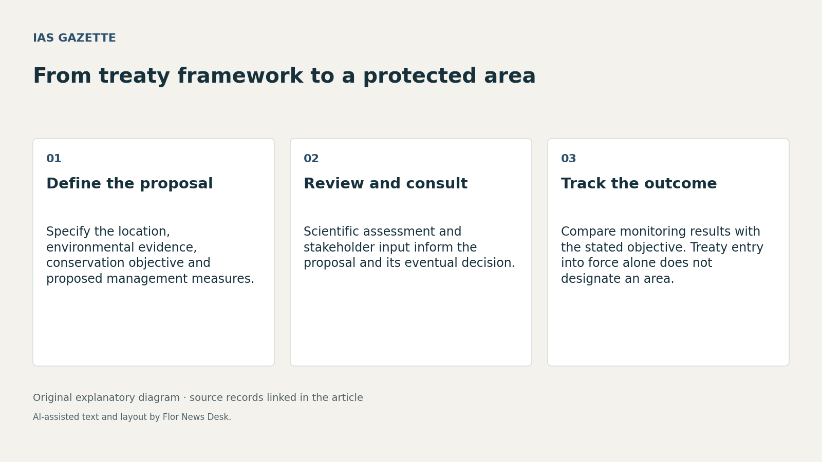
Articles 19–22 of the agreement’s certified text describe the route for area-based measures, including marine protected areas. Parties submit proposals containing geographic information, environmental context, objectives and a draft management plan. The process includes scientific review, public consultation and a decision by the Conference of the Parties, with coordination across relevant bodies.
That structure gives readers several documents to look for. A map can show the proposed boundary. The supporting evidence should explain why that area was selected. The management plan should identify the measures intended to achieve the objective.
A hypothetical proposal to protect a breeding area illustrates the distinction. Its size, taken alone, would say little about whether the boundary covers the relevant habitat at the right time. A smaller area with an appropriate measure might address a specific pressure more directly than a larger boundary with weak practical coverage. Assessing that possibility would require actual ecological and activity data.
Consultation creates an evidence trail
The treaty provides for consultation contributions and consideration of them during the proposal process. Article 22 also requires respect for the competences of relevant existing institutions and frameworks. The procedure is therefore more involved than one institution drawing a line on a map and declaring every management question settled.
For an observer, the useful comparison is between the initial proposal and the version submitted for decision. Did the boundary change? Were additional activities considered? Did the proponent explain why a suggested change was accepted or rejected?
Those are reporting questions, not findings about a proposal already under consideration. This article examines the treaty process and does not claim that a specific protected area has been established or assess the current status of any application.
Protection needs a measurable objective
Once a measure is adopted, judging its effect requires a starting point and a monitoring method. An increase in reported observations could reflect more monitoring rather than ecological recovery. A reduction in one activity might coincide with another pressure increasing.
A credible assessment would connect the conservation objective to the evidence collected over time. It would identify who gathers the information, how results are compared and when management can be adjusted.
The entry-into-force notification and treaty text answer institutional questions. Evidence about an individual area must answer different ones. Following the proposal, consultation record, decision and monitoring results would give readers a clearer account of what protection means in practice than a headline about ocean area alone.
Read our editorial standards or send a correction to the editorial desk.